That kind of action is ‘unacceptable,’ a farm group says
By Diego Flammini
Staff Writer
Farms.com
An ag organization spoke out against striking federal workers demonstrating at an export terminal.
On April 24, about 100 Public Service Alliance of Canada (PSAC) workers picketed at the Cascadia Terminal in Vancouver, B.C.
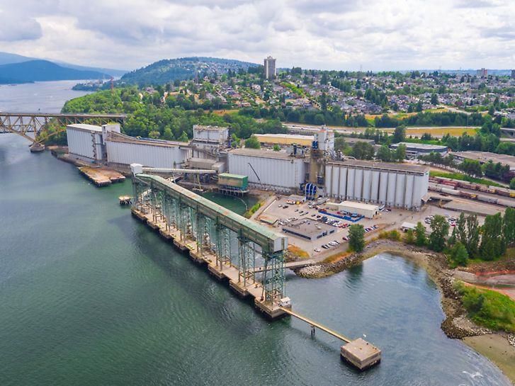
This terminal is a joint venture between Viterra and Richardson International with a storage capacity of over 280,000 MT and the ability to unload, process and ship more than 6 MMT of grain annually, its website says.
That same day, workers demonstrated at a Viterra facility at the Port of Montreal.
Picketing at grain facilities like the one in B.C. prevents grain from receiving inspection and permission for export.
Targeting an important grain export terminal is unacceptable, said Gunter Jochum, president of the Western Canadian Wheat Growers Association.
“A strike is one thing, but to intentionally target a port that is critical to the lives of grain farmers and to the entire Canadian economy is the height of reckless irresponsibility,” he said in a statement. “It’s time for the federal government to intervene.”
In total, about 155,000 PSAC workers across the country are on strike, with multiple industries feeling the strike’s effects.
About 3,000 workers are involved with agriculture, whether it’s with Agriculture and Agri-Food Canada or the Canadian Grain Commission.
The Wheat Growers is asking the federal government to change the Canada Grain Act to authorize third party weighing and inspection for vessels.
“Canadian farmers pay over $60 million per year to have CGC staff inspect their grain,” the organization says. “70% of the vessels leaving this country only require third party results; Canadian farmers are unnecessarily paying for a double inspection.”
Farmers are watching the PSAC strike situation very closely.
The longer the strike continues, the more likely Canada’s ag sector faces backlogs and other challenges, said Jill Verwey, president of Keystone Agricultural Producers.
“We respect the right to negotiate, but we want to ensure this situation doesn’t have a negative impact on outward inspection and make sure the government has contingency plans in place,” she told Farms.com. “We don’t want to end up with backlogs on the export side, because that can end up being a supply issue for some of our inputs. We’re keeping an eye on this very closely and are staying as up to date as we can.”
The federal government hasn’t provided concrete answers about if it would introduce back-to-work legislation to end the strike.
And the NDP, who’s supporting the government through a supply-and-confidence agreement, indicated it wouldn’t support such legislation.