By Pam Knox
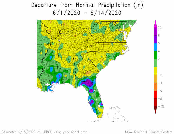
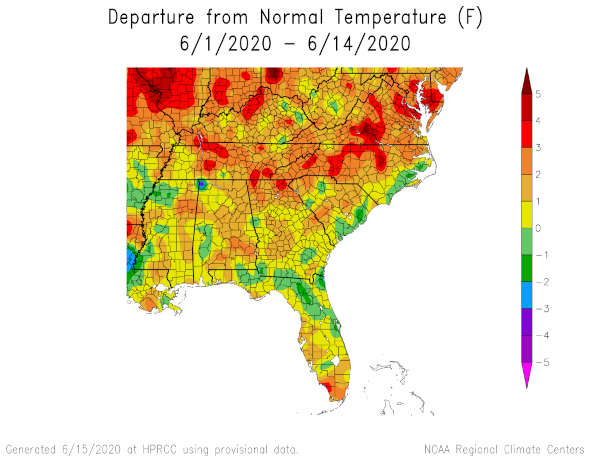
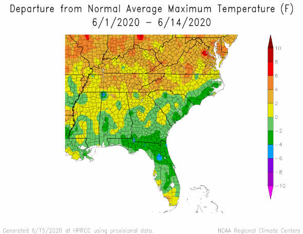
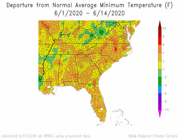
Now that we are halfway through June, 2020, let’s take a look at the climate for the month so far. Precipitation is quite variable and most places are drier than normal. The exception is along the Gulf Coast and in southern Georgia and Alabama and in Florida due to the rain that fell as TS Cristobal was approaching the Louisiana coast. Temperatures across the region were mostly above normal for the month so far, with the coolest areas in the same regions that got the most rain. That was due at least in part to more cloud cover there, although the rain certainly also caused evaporative cooling. It is interesting to note that nighttime minimum temperatures were warmer than normal across the region, which is what we expect due to long-term trends, and it was the daytime high temperatures that were mostly cooler than normal in the rainiest areas. So from this we can see that tropical storms affect not only precipitation, but also regional and local temperature patterns. Fortunately, the tropics are not active right now, so we don’t expect much more impact in the next couple of weeks, but watch for increased activity in August as the peak of the season gets closer.