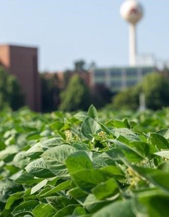
In the age of herbicide resistant weeds, the herbicide dicamba is a useful tool to Minnesota soybean farmers.
Much like the RoundUp Ready beans of the 90s, today’s dicamba-tolerant varieties allow farmers to spray their fields with dicamba to kill weeds that are resistant to most other herbicides on the market, while leaving the soybeans completely intact.
Dicamba application has grown in popularity in Minnesota and across other soybean growing regions of the United States since dicamba-tolerant soybeans hit the market. It’s an effective tool in the fight against broadleaf weeds, where resistance has rendered many herbicides ineffective.
But dicamba has a downside — it tends to evaporate and drift across the landscape onto neighboring properties.
If the crops and plants on those neighboring properties aren’t dicamba-tolerant, the herbicide damages them. This unintended dicamba drift and volatilization has injured thousands of acres of crops and other landscapes.
Research driving the response
With support from Minnesota’s Rapid Agricultural Response Fund, CFANS Professor Tim Griffis, PhD, and his team have been conducting research to better measure and understand how dicamba moves across the landscape since it became popular in Minnesota five years ago.
Griffis’ research is driving the response to the dicamba problem. “Our research findings have been used to inform MDA and EPA regarding key cutoff dates for application and buffer limits recommended for planting,” he explains.
Research conducted in 2018 and 2019 that showed dicamba damaged crops more than 164 feet from the application field, well beyond the recommended 110-foot buffer zone at the time. The Environmental Protection Agency increased the required buffer zone to 240 feet in 2021.
By analyzing long term wind speed, surface temperature and atmospheric stability data, Griffis and his team also found that there’s a very limited window of time when it's safe to apply dicamba. The Minnesota Department of Agriculture used this research knowledge to help set an annual June 20th cutoff date for registered dicamba products to prevent off-site movement from 2018 to 2020.
Addressing the challenges in Minnesota
Despite regulatory changes to help minimize dicamba drift and damage, the Minnesota Department of Agriculture received over 300 complaints of dicamba injury in 2021 alone. The MDA has proposed stricter application date and temperature cutoff regulations on dicamba use in Minnesota for 2022.
Griffis and his team are currently working to better understand the factors that influence dicamba losses and crop damage to provide best management practices for application in Minnesota.
They’re also studying what factors contribute to the dicamba damage ‘hotspots’ observed in south-central Minnesota. They hypothesize that relatively high application rates in south-central Minnesota, more stable atmospheric conditions, and higher probability of cold air drainage cause persistent damage in that region of the state.
In addition to guiding regulatory decisions, Griffis’ findings will be used to develop a dicamba transport calculator to help farmers and co-ops make informed application decisions based on environmental and atmospheric conditions.
The fate of dicamba may be uncertain, but the research will continue to be put to good use.
Source : umn.edu