By Aaron Wilson
Soil Temperatures and Moisture

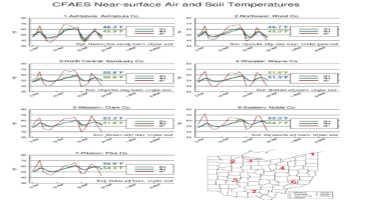
Figure 1: Daily average air temperature (dashed red), two-inch (green) and four-inch (blue) soil temperatures for spring 2023. Soil type and location of measurements (under sod or bare soil) are provided in the lower right corner of each panel. A map of all locations is in the bottom right. Data provided by the College of Food, Agricultural, and Environmental Sciences (CFAES) Agricultural Research Stations located throughout the state.
The weather took a turn this past week toward cooler temperatures, running 1-3°F below average across much of the state. This has dropped daily average soil temperatures about ten degrees off their high points last week (Figure 1). Northern locations are now running in the mid to upper 40s, with low to mid 50s across central and southern Ohio.

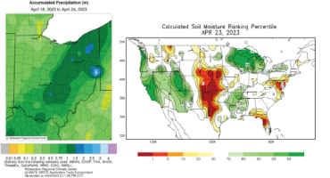
Figure 2: (Left) Total precipitation over the 7-day period of 7am April 18 – 7am April 24, 2023. Figure provided by the Midwestern Regional Climate Center. (Right) Calculated soil moisture percentiles as of 4/23/2023 according to the Climate Prediction Center.
Precipitation varied across Ohio last week, from less than 0.2” in northwestern counties to isolated amounts greater than 2” (Figure 2-left), with the heaviest falling along and to the east of I-71. CoCoRaHS observations show 2.31” fell in Licking County with a report of 2.26” out of Lorain County. Soils continue to dry out across portions of western and southeast Ohio, with soil moisture starting to drop below the 30th percentile compared to historical conditions (Figure 2-right). For more complete weather records for CFAES research stations, including temperature, precipitation, growing degree days, and other useful weather observations, please visit https://www.oardc.ohio-state.edu/weather1/.
Weather Forecast
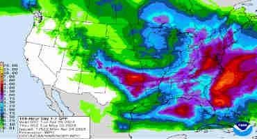
High pressure will slowly take control through mid-week this week, though a few isolated showers (possibly mixed with grapel/snow pellets) are possible on Tuesday. Overnight temperatures will flirt with freezing across the state Tuesday and Wednesday mornings, so Frost and Freeze Warnings/Advisories will likely be in place. Daytime highs will only reach the 50s through Thursday. Temperatures will moderate into the 60s on Friday through the weekend, but a complex system will bring ample moisture to the state over the weekend through Monday. The Weather Prediction Center is currently forecasting 0.75-2.00” of precipitation this week, heaviest across eastern Ohio (Figure 3).

Figure 3). Precipitation forecast from the Weather Prediction Center for 8pm Monday April 24 – 8pm Monday May 1, 2023.
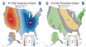
The 6-10 day outlook from the Climate Prediction Center and the 16-Day Rainfall Outlook from NOAA/NWS/Ohio River Forecast Center show below average temperatures are likely with near normal precipitation (Figure 4). Climate averages include a high-temperature range of 66-71°F, a low-temperature range of 45-48°F, and weekly total precipitation of about 0.85-1.15”.

Figure 4) Climate Prediction Center 6-10 Day Outlook valid for April 30 - May 4, 2023, for left) temperatures and right) precipitation. Colors represent the probability of below, normal, or above normal conditions.
Crop Observation and Recommendation Network
C.O.R.N. Newsletter is a summary of crop observations, related information, and appropriate recommendations for Ohio crop producers and industry. C.O.R.N. Newsletter is produced by the Ohio State University Extension Agronomy Team, state specialists at The Ohio State University and the Ohio Agricultural Research and Development Center (OARDC). C.O.R.N. Newsletter questions are directed to Extension and OARDC state specialists and associates at Ohio State.
Source : osu.edu